
Project: Saltmarsh Toolkit
Client: Lane Cove River Estuary Management Committee
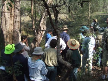
Applied Ecology developed a “toolkit” for managing Saltmarsh on the Lane Cove River. The toolkit consists of three manuals covering planning, site assessment and monitoring and rehabilitation. The project involved mapping all extant saltmarsh and developing reports covering planning context, site assessments, rehabilitation priorities and monitoring. Applied Ecology also ran a one day workshop for local and state government officers involved in managing saltmarsh.
Lane Cove, Hunters Hill, Willoughby and Ryde Councils combined to form the Lane Cove River Management Committee to ensure and secure the sustainable future of this river system. Saltmarshes that once dominated the banks of Lane Cover River have now been degraded and impacted by urbanisation, and displaced by mangroves. Today, only fragments of saltmarsh areas remain, and are placed under constant pressure from multiple processes including development, sedimentation, changed hydrology, mangroves expansion and climate change.
The aim of this project was to provide an overview and detailed site specific advice on planning for healthy saltmarsh communities into the future. The project covers mapping saltmarsh patches within the estuary to update and refine existing mapping, planning for rehabilitation, rehabiliation strategies, recovery potential, monitoring legislative requirements, and management of threatening process.
The project was assisted by the New South Wales Government through its Estuary Management Program.
Saltmarsh Survey
Prior to a ground-based assessment of flora, a search of the Index of NSW Flora was undertaken to identify possible threatened flora species that may be present in any saltmarsh site (PlantNET, 2008). In the field, areas of previously mapped saltmarsh and areas of potential saltmarsh were examined. When saltmarsh species were located, the area was traversed and inspected using the random meander method (Cropper, 1993). The difficulty of the terrain, based on dense vegetation or mud or deep water meant that keeping to a strict transect was difficult and potentially damaging to the environment. Saltmarsh plant species present, vegetation community type and quality were identified and recorded. Dominant species for each area were recorded and the percentage cover of each saltmarsh patch
(excluding exotics). Saltmarsh species generally fall into three broad categories based mainly on types of plants present and tolerances to salinity (adapted from DECC, 2008):
• shrubs and herbs that can tolerate hypersaline conditions, such as the small, colourful succulent species Sarcocornia quinqueflora and Suaeda australis: classed as Herb-dominated Saltmarsh, or Succulent-dominated Saltmarsh
• sedge and rush swamps, usually found in the upper marsh fringe associated with brackish water conditions and dominated by rushes and sedges (for example, Juncus kraussii, Baumea juncea and Cyperus laevigatus): classed as Sedge and Rush Swamp, or for monocultures, eg. Juncus kraussii Swamp.
• grassland areas, usually inundated less frequently and dominated by grasses such as Sporobolus virginicus, Zoysia sp. and Distichlis sp.: classed as Grass-dominated Saltmarsh The majority of the marshes found in temperate Australia can be considered as a single community complex dominated by one or a combination of S. virginicus, S. quinqueflora, S. repens and T. striata.
Three reports were developed:
The Planning Manual
This report was underpinned by the principle that catchment scale planning is required. Careful planning choices pre-empt the choices that need to be made at the, sometimes contentious , development application stage and good planning should help remove the singular focus on single projects and ensure healthy saltmarsh communities into the future. It is clear that a number of processes affect the vegetation structure of mangroves and saltmarsh and influence their respective roles in the ecological functioning of the Lane Cove River estuary. Depending on the type of processes identified, various planning strategies can be ulitised to ensure the protection of both mangrove and saltmarsh vegetation and support attempts to undertake site specific management activities. This report coverstopics from strategic planning through to consent considerations at the development application stage.
The Monitoring Manual
This report was prepared to provide strategies for monitoring change in saltmarsh condition over time.
Monitoring is a very important component of successful management and rehabilitation of wetland environments. There are two main types of change that are generally the focus of a monitoring program:
1) Monitoring may be used to determine when a saltmarsh is moving away from its desired state, to measure the success of management actions, and to detect the effects of disturbances to the saltmarsh (baseline monitoring).
2) Monitoring may be used to track the responses of saltmarsh to rehabilitation activities (rehabilitation monitoring).
Since monitoring addresses the extent of change within the environment, which is naturally variable, monitoring studies require a degree of scientific rigour. This does not mean that an effective monitoring program is necessarily complex or expensive, just thorough and well designed with clear objectives. Inadequate or inappropriate sampling design and lack of clear objectives in past monitoring programs has led to a failure to deliver useful information when required (Chapman & Underwood, 2000).
Saltmarsh Site Assessment Report
This report provided general information to guide Council staff on best practice methods to protect and rehabilitate saltmarsh areas. In part, the challenge of the project was to translate this overview and the results of the saltmarsh survey into practical rehabilitation actions that the LCEMC can instigate successfully.Revegetation and rehabilitation sites (including suitable sites for retrofitting of SQIDS or WSUD features) identified through remote sensing, stakeholder consultation and field work have been collated into a prioritised action plan. For each site a report card was developed along with a rehabilitation plan aiming to provide the following:
• Priority for rehabilitation
• Operational change (eg. no mow zones, improved maintenance of GPTs and pits)
• Capital investment (eg. fencing riparian buffers)
• Education (eg. Scope and focus of education programs, interpretive signage, support for
Bushcare and Landcare, landholder incentives Voluntary Conservation Agreements or Property
Vegetation Plans)
• Policy (eg. development setbacks, buffers, and offsets)
• Extent of area to be rehabilitated
• Objectives of rehabilitation work (eg. management of pollutants, flood mitigation, erosion
reduction, habitat enhancement, water quality improvement);
• Type of work required (eg. replanting, natural assisted regeneration, bank stabilisation,
installation of SQIDS, inlet channel modification);
• Resources required (labour – volunteer or paid, expertise, infrastructure, machinery, and plants)
• Measureable targets for rehabilitation and change