Since 2009 the team at Applied Ecology have developed and completed numerous projects. These projects range from small to large, some with small study areas and some with study areas that encompass entire major catchments or local government areas. Below is a sample of projects undertaken over the past few years.
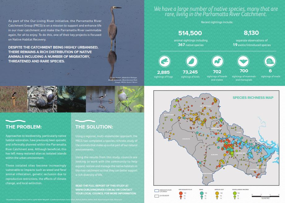
Project: Parramatta River Catchment Fauna Habitat & Biolinks Project
Client: The Parramatta River Catchment Group (PRCG)
2014-15
The PRCG is a regional organisation of local councils, state agencies and community representatives whose aim is to work together to improve the health of the Parramatta River catchment. A steering committee supervised this project and included representatives from Ashfield, Auburn, Blacktown, Canada Bay, Hunters Hill, Ryde, Parramatta and Strathfield Councils, Sydney Olympic Park Authority, and BirdLife Australia.

This study underpins the native habitat recovery in the Parramatta River catchment project, which aims to expand, restore and manage the extent of native habitats in the fragmented landscapes of the Parramatta River catchment. This collaborative project has been funded through a NSW Environmental Trust grant, and involves a series of distinct stages including research, assessment and delivery of on-ground works.
PART 1
- The collation of existing data (including each Council’s fauna studies, HNCMA’s Rapid Fauna Habitat Assessment, HNCMA’s Draft Native Vegetation of the SMCMA Area report, Sydney Olympic Park Authority’s fauna studies, BirdLife Australia’s bird data, OEH’s Linking Landscapes Through Local Action project and the Atlas of NSW Wildlife
- Supplementary surveys for areas with poor or no data available
PART 2
- A review of literature relating to the development of urban biodiversity corridors
- Ranking fauna habitat sites based on their fauna species richness
- Identifying key existing and potential vegetation corridors linking high priority sites across the landscape
- The identification of high value sites, potential and existing biodiversity corridors, and recommendations for future works including appropriate revegetation species to improve the overall quality of identified and potential fauna corridors
Project: Roadside Vegetation Mapping and Management Guidelines
Clients: Lachlan Shire Council, Young Shire Council, Cowra Council, Blayney Council, Boorowa Council, Wellington Council, Gilgandra Shire Council and Weddin Shire Council
2012-2016
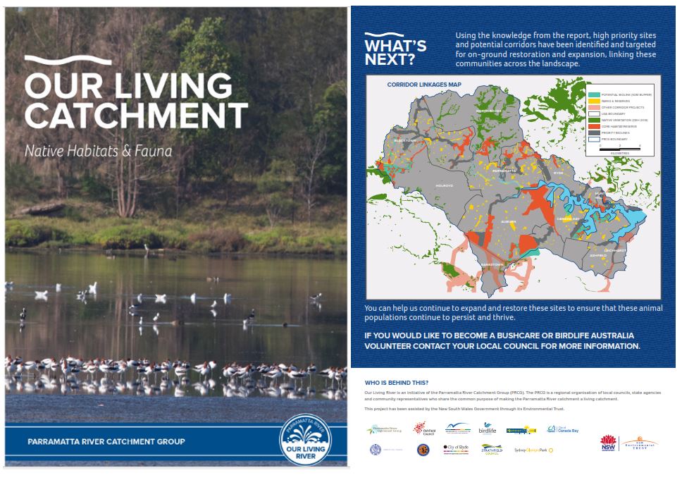
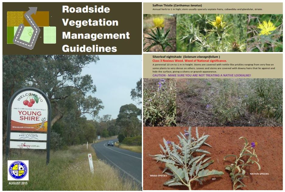
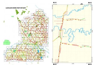
Applied Ecology mapped the roadside vegetation for over 20,000 kilometres of roads in the central west and tablelands of NSW.
We created a map books and key guides for use by Council’s operational staff showing locations of EECs, threatened species and other special features located in road reserves. Roadside corridors were ranked based on conservation value and were given a simple colour code with guidelines developed on how to manage each “rank”. A guide to environmental weed and threatened species identification was also provided.The large database (including species inventories, noxious weeds, vegetation condition for each “section” of road reserve) were integrated into Councils’ GIS systems. Building upon this new comprehensive layer of information Applied Ecology prioritised roads for rehabilitation works and prepared technical reports on the vegetation condition of the road reserve networkfor each LGA. In recent surveys we have undertaken biodiversity mapping integrating data from numerous sources to assist with identifying biodiversity hotspots.
Project: Threatened Species Surveys
Client: Mid-Western Regional Council
2015
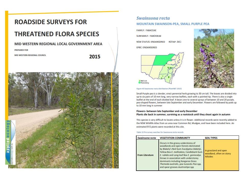
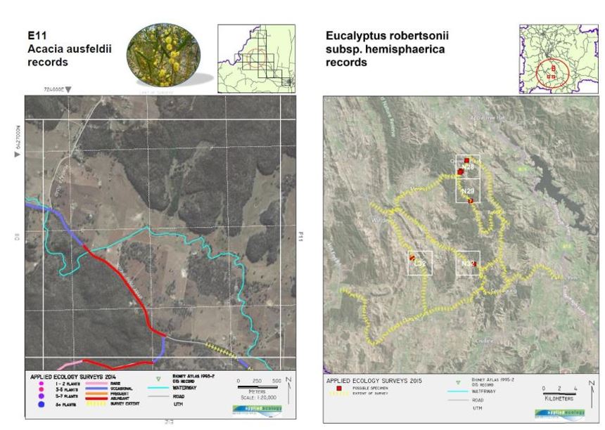
Historic records of threatened flora species on or near roadside reserves were verified for currency and surveys undertaken in suitable habitat for new records. New locations for threatened species were documented adding 100’s of records to the NSW Wildlife Atlas. This project enhanced Council’s ability to plan roadside maintenance activities to minimise impact on rare and threatened flora.
Project: Watercourse Assessment and Rehabilitation Prioritisation Plan
Client: Sutherland Shire Council
2012-2013
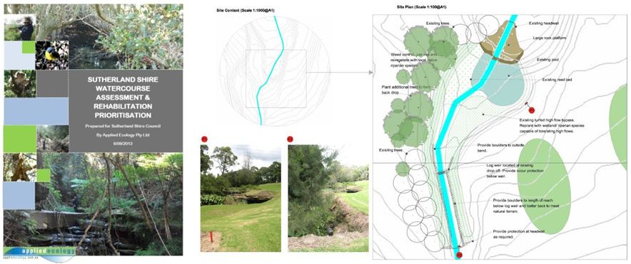
The Watercourse Assessment and Rehabilitation Prioritisation Plan was prepared in 2011/12 for Sutherland Shire Council. The aim of this study was to assess the condition of watercourses within the Sutherland Shire Local Government Area and to develop prioritised rehabilitation actions. Consultation with key stakeholders both within Council and the broader community was an integral part of this study.
The objective of the study is to produce a Watercourse Condition, Prioritisation & Rehabilitation Report and associated maps which:
• identified stakeholders and their stream management issues
• established baseline stream conditions
• undertook an assessment of current stream conditions
• identified the natural assets and problems of streams
• evaluated stream conditions, assets and problems and prioritised their rehabilitation
• developed strategies to undertake the rehabilitation works
The project involved the assessment of around 250km of streams, which were divided into over 1000 reaches, or stream sections.
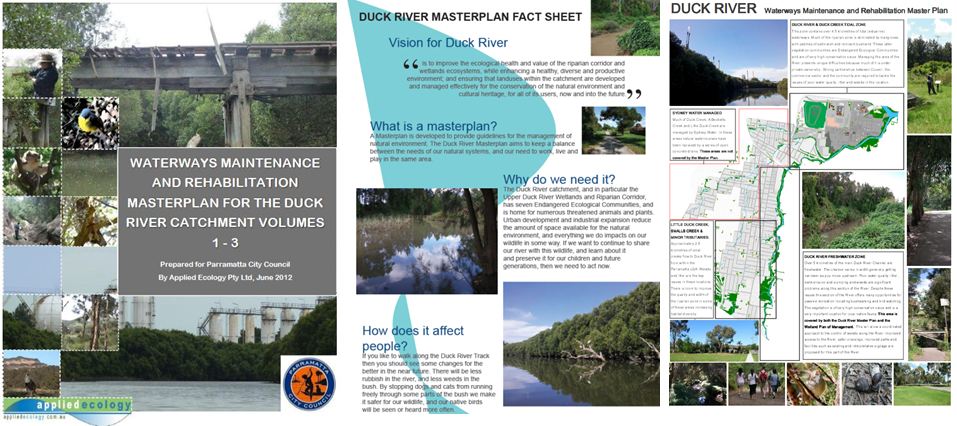
Project: Duck River Waterways Maintenance and Rehabilitation Master Plan
Client: Parramatta City Council
2012
In order to develop a consistent and agreed maintenance and regeneration program for the Duck River Catchment, a ‘Waterways Maintenance and Rehabilitation Master Plan’ was required by Parramatta City Council. Applied Ecology prepared a Master Plan designed to be the primary guiding document in the management of the Duck River catchment and provided a framework and foundation for the necessary collaboration between the relevant state and local government authorities for the associated maintenance and rehabilitation planning and works. Preparation of the plan included a detailed review of past land uses, past and current management regimens, cultural heritage assets, community consultation and workshops and detailed mapping of:
* comparative land use, with typical cross-sections for each reach;
* geomorphic features (bank type, pools, erosion points, deposition zones, bed material etc);
* stream behaviour and processing zones, existing bank structure/works, floodplain limits;
* vegetation associations, aquatic flora and fauna, level of weed infestation, significant snags, vegetation blockages
* physical features/structures, barriers;
* stormwater outlets, including piped and open channel drainage within the catchment (location, impact, litter loads, scour etc).
Ultimately the Master Plan aimed to document desirable and achievable outcomes for the waterway overlaid with actions to bring the “vision” to fruition.
Project: Great Blue Mountains Trail
Client: Blue Mountains City Council
2011-2012
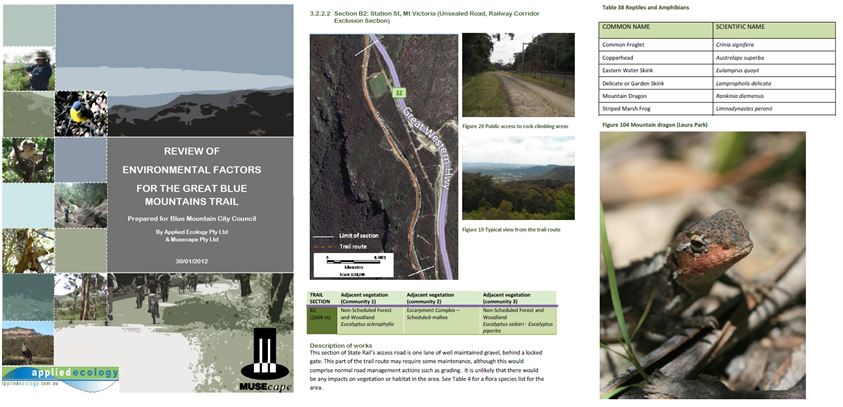
Applied Ecology prepared a Review of Environmental Factors (REF) Under Part 5 of the Environmental Planning and Assessment Act 1979 along the proposed route of the Great Blue Mountains Trail (GBMT) from Wentworth Falls to Mount York.
The review of the route considered the following:
1. Possible impacts to the environment including endangered ecological communities, areas of natural vegetation, noise, air, soil, water, visual and access impacts, and
2. Heritage/Cultural analysis.
Project: Woodford Bay – Dinghy Rack Concept Plan
Client: Land Cove Council
2011-12
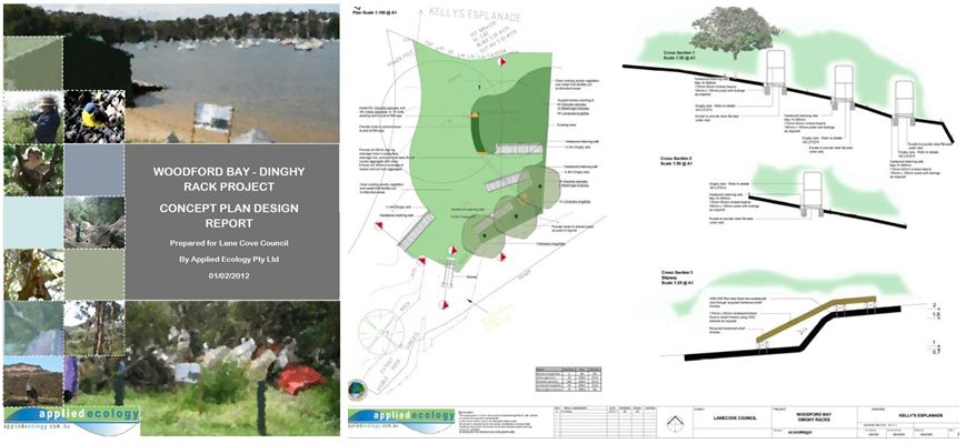
To assist with conservation of EECs and other sensitive vegetation on the foreshore Applied Ecology developed a concept plan aimed at providing alternatives to informal and adhoc storage of dinghies along the foreshore. As part of this process Applied Ecology completed the following tasks:
• production of a comprehensive concept plan and design report for the installation of dinghy racks at Woodford Bay, Longueville.
• before & proposed after photo montages and “illustrations” of dinghy rack areas.
• extensive community consultation
• production of detailed landscape designs for each dinghy rack site and Woodford Bay area (dimensioned drawings).
Project: Vegetation Mapping and Fauna surveys
Client: Parramatta City Council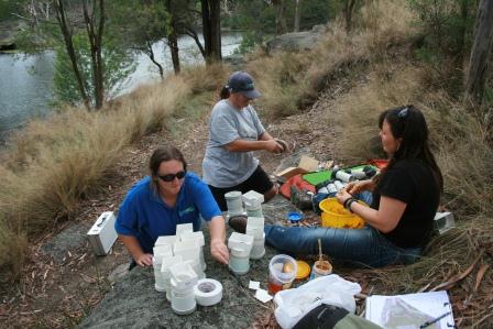
2011-12
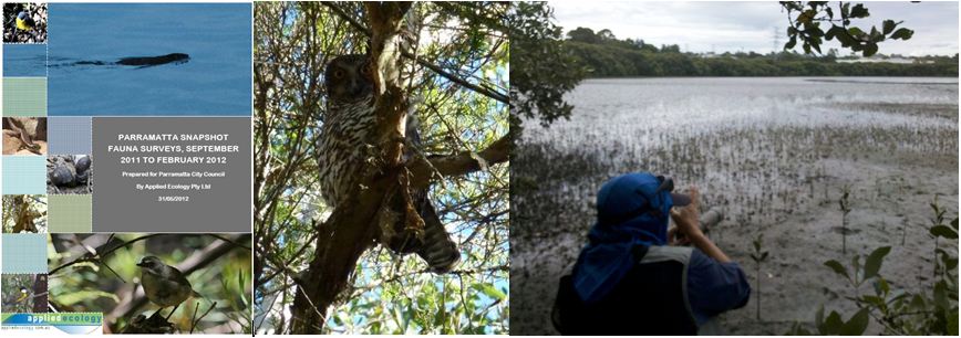
Applied Ecology was contracted to map the vegetation and develop species inventories for the core bushland areas within the Parramatta LGA. Eight Ecologically Endangered Communities were confirmed across eight large reserves systems. Techniques used included spotlighting, hairtubing (preparation pictured at right), stag watching, bat surveys (using Anabat © SD2 detectors) searches of habitat and dawn chorus observation. In all, 424 flora species and 114 fauna species were recorded including 13 Threatened species. The threatened Powerful Owl (at left) was regularly sighted and several individuals (and at least one breeding pair) are long term residents of Parramatta.
Project:Saltmarsh Toolkit
Client: Lane Cove River Estuary Management Committee
2010
Applied Ecology developed a “toolkit” for managing Saltmarsh on the Lane Cove River. The toolkit consists of three manuals covering planning, site assessment and monitoring and rehabilitation. The project involved mapping all extant saltmarsh and developing reports covering planning context, site assessments, rehabilitation priorities and monitoring. Applied Ecology also ran a one day workshop for local and state government officers involved in managing saltmarsh. More info…
Project: Wyong River and Ourimbah Creek Streambank Stabilisation
Client: Wyong Shire Council
2010
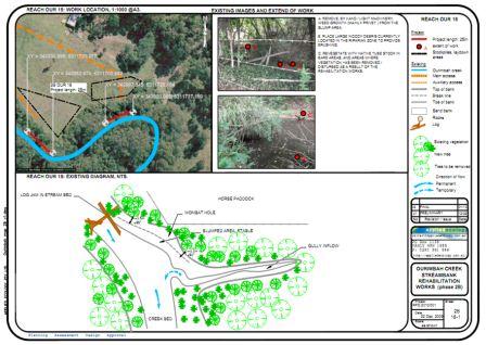
Applied Ecology developed designs for over 40 river and stream bank sites requiring stabilisation. Strategies ranged from hard engineering solutions to fencing and revegetation of riparian zones. Applied Ecology also undertook all environmental assessments required to obtain the necessary approvals for the projects to proceed.
Project: Roadside Vegetation Mapping
Client: Mid-western Regional Council
2010-11
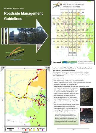
Applied Ecology mapped the roadside vegetation for approximately 2400kms of roads within the Mid-western Regional LGA. Applied Ecology created a A5 map book (right) for use by Council’s operational staff showing locations of EECs, threatened species and other special features located in road reserves. Roadside corridors were ranked based on conservation value and were given a simple colour code with guidelines developed on how to manage each “rank”. A guide to environmental weed and threatened species identification was also provided.The large database (including species inventories, noxious weeds, vegetation condition for each “section” of road reserve) was integrated into Council’s GIS system. Building upon this new comprehensive layer of information Applied Ecology prioritised roads for rehabilitation works and prepared a large technical report on the vegetation condition of the road reserve network in the LGA.
Project: Weed Mapping & Biodiversity Mapping
Client: Parramatta City Council
2010
Applied Ecology reviewed biodiversity mapping and updated the Conservation Significance Assessment (CSA) GIS layer for the Parramatta LGA and updated mapping inline with the most up to date vegetation mapping (left). Applied Ecology undertook fine scale weed mapping(right) at the eight core bushland areas within the LGA and developed a user friendly database to allow Council staff and contractors to replicate the mapping and undertake baseline mapping in other bushland areas in the future.
Project: Landscape Design (in a sensitive environment) and EEC survey & monitoring
Client: Pacific Beverages
2009-2012
Applied Ecology provided detailed landscape designs and devised a programme of landscaping and bush regeneration works at a large commercial Brewery on the Central Coast. This project aimed to enhance and protect degraded Endangered ecological communities and threatened species on site in line with various agency requirements. Applied Ecology also provided supplementary surveys of threatened species, advice on nest box placement, construction and installation and supplementary planting plans.
Project: Spring Creek streambank stabilisation
Client: Wyong Shire Council 2010
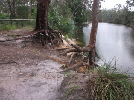
Applied Ecology supplied all documentation required to gain approval for streambank stabilisation works required on three reaches of Spring Creek. These reaches were extremely degraded exhibiting bank slumping and severe undercutting resulting in the mobilisation of considerable amounts of sediment and the loss of mature trees.
Project: Bathurst Urban Drainage Vegetation Link
Client: Bathurst Regional Council 2010
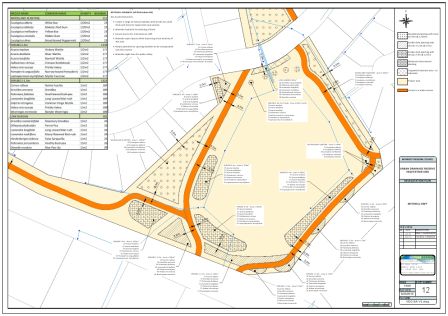
Applied Ecology provided landscape designs for 11 significant urban sites in Bathurst City. These works were identified in Bathurst’s Urban Waterways Management Plan. The designs achieved the following objectives:
• To improve aquatic habitat, riparian vegetation and water quality in urban stormwater creeks in Bathurst through the creation of the Urban Drainage Reserve Vegetation Link.
• To inspire an understanding of and commitment to sustainability through innovative on-ground works and community engagement.
• Engage in inclusive community collaboration and build long term community capacity.
Project : Blacktown City Flora and Fauna Surveys
Client: Blacktown City Council
Applied Ecology undertook comprehensive Spring, Summer and Winter flora and fauna surveys across three reserves in the Blacktown LGA. Threatened species Grevillea juniperinum and Pultanea parviflora (pictured at left) were located at Mt Druitt and regionally significant microbat species and gliders were also located.

